Walking route Old Koog aan de Zaan
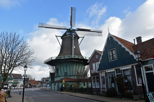
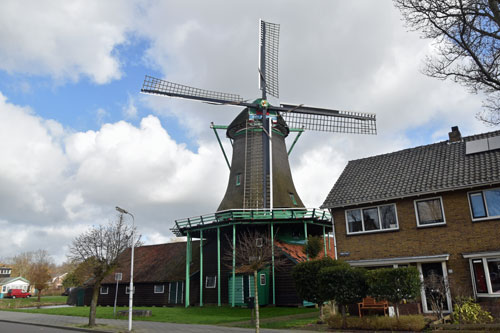
- Lagedijk 28: The flour mill “De Bleeke Dood” (1656) is the oldest wooden tower mill in The Netherlands. It marks the end (or beginning) of the village. After a long period of neglect, it was restored and in 1954 it was put back into use by the Zaansche Windmill association.
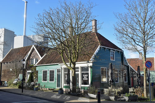
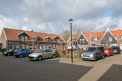
- Lagedijk 7/9: this is one of two truncated farmhouses (1684) still present in the Zaan area. The other one is at the opposite of the crossing, at nr. 13. It was built as a butchers/residential house, but for a long time was also a bicycle shop/home.
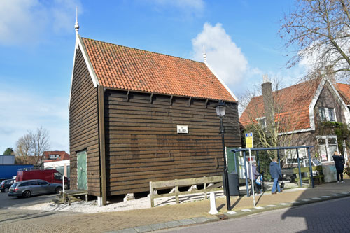
- Lagedijk 3: paper warehouse “De Baars” (about 1675). In 2004 it was moved from the banks of the Zaan river opposite its current location and restored. Property of the Zaanse Warehouse organization and storage for books.
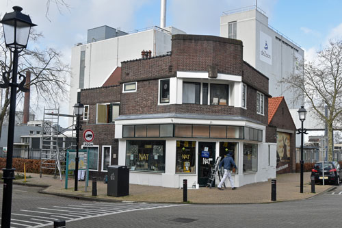
- Lagedijk: Cacao de Zaan/Olam, established in 1911, is one of the biggest cocoa processing industries in the world. They make cocoa-mass, butter and powder, but not chocolate. The company’s museum stands on the corner of Stationsstraat/Hoogstraat 31.
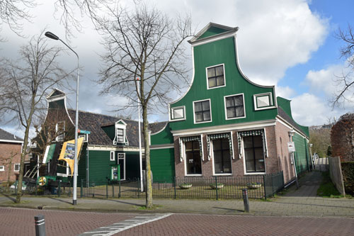
- Hoogstraat 16: Zaanse ornamental garden with a winged female figurine over the door. Previously this was the site of a distinguished residence, now a traditional ornamental garden.
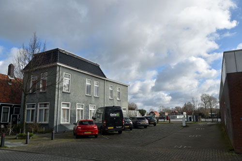
- Hoogstraat 2: “De Waakzaamheid” (1626), traditionally an inn, later a hotel/restaurant and dance location, since its restoration (2012) it is now a restaurant and also a home. It stands next to the former “Kogersluis” (1729-1970). The stone lock walls are still present, but the water has gone.
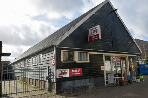
- Lagendijk 66: whalers’ warehouse “Asia” (ca. 1725) storage for whaling supplies, but also for other goods. Restored in 2010. Stands next to one of the oldest industrial areas in Europe: “the Koger Hem”. The machine factory P.M. Duijvis makes machines here for the cocoa processing industry.
- Lagendijk 41: “The Johanna Elisabeth Stichting” (1911). Baptist orphanage and old people’s home. Built thanks to the legacy of the baker Hendrik Sweepe. After its sale in 1968 it became a protected residence.
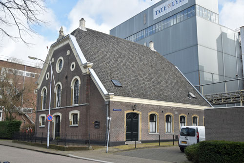
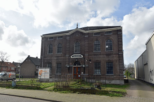
- Lagendijk 34: “The Koger Vermaning”, 17th century Baptist “hidden” church. Next to it Honig (now Tate & Lyle) started in 1867 with the manufacture of wheat starch and is now one of the biggest producers of, among other things, starch made from maize.
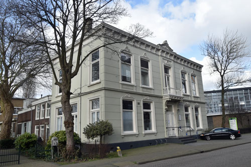
- Lagendijk 3a: former villa of the Honig family in 1880, on the pediment is the family crest: a beehive. “The Clockmaker houses” at nr. 1 date from the 17th century and were restored in 2019. On the right in Sportstraat are the former executive homes of the “Stijfselfabriek de Bijenkorf”.
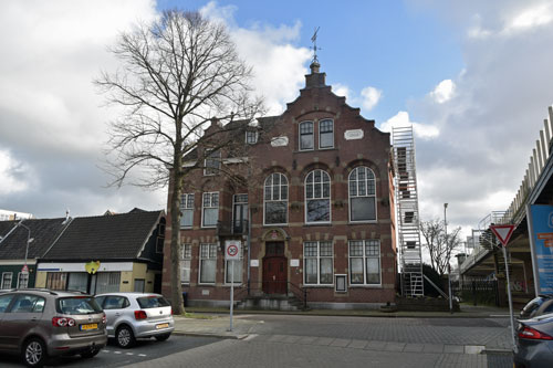
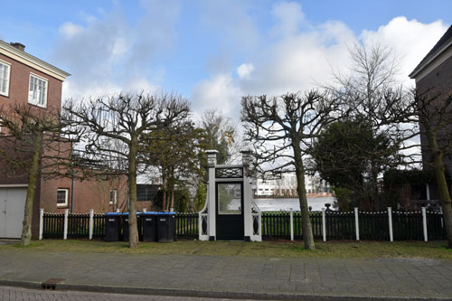
- Raadhuisstraat 86: former city hall from 1908, built also thanks to the legacy of the baker Hendrik Sweepe. It is a pity that since 1967, the A8 highway cuts the Koog village in two.
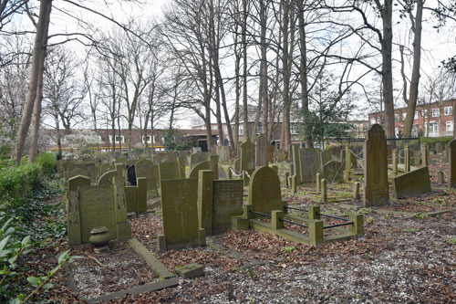
- Kerkstraat 14: behind “the Kogerkerk”, founded with help from the Baptist Community (1686), lies an older graveyard (1645). Next to the church square, at the corner of Zuiderkerkstraat, is the oldest house in Koog aan de Zaan (1625). Next to:
- Raadhuisstraat 2 is the former approach to “the Noorderbrug” (1902-1976). The replacement bridge to the south, the Prins Willem Alexanderbrug, was built in 1976.
- Zuideinde 83: former orphanage and later an old people’s home, “the Kogge” (1860) of the Ned. Reformed Church. It has also served as a hotel, asylum seekers centre and accommodation for temporary workers.
- Zuideinde 20: residential house (18th century). Nine Jewish people hid on the 1st floor (1942-1945). Two weeks before liberation Rachel Speyer-Pais was shot through the window by a German bullet. For fear of discovery the others buried her at night in the garden. After liberation, she was buried again in a Jewish graveyard. Walk up to the bridge from the lock:
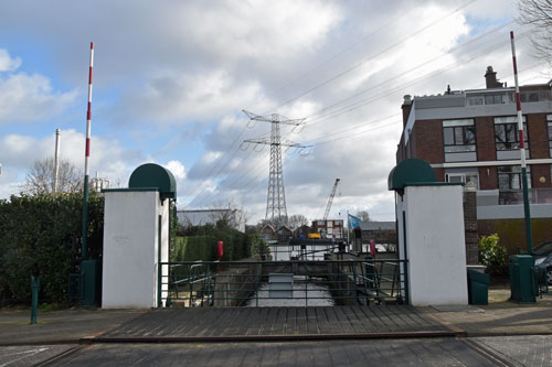
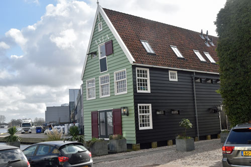
- “The Mallegatsluis” (1634), the border between Koog and Zaandam, with on the left side of the canal a view on the warehouse “de Zeug” (17th century) situated on the Ameland. Go back and turn left to the first street left:
- Breedweer: A long neglected area of old Koog but recently the Breedweer is again a residential area. At nr. 41, the oil warehouse “De Bonte Kieft” (18th century). Turn right at the end of the Breedweer to:
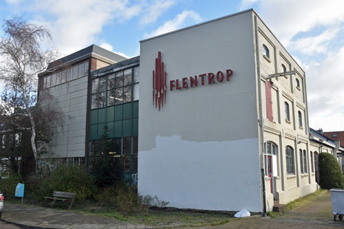
- Parallelweg 10: the former gas factory van Koog houses the timber workshop of the firm Flentrop, which carries out restoration work, but also makes new church organs. Walk straight on, at Station Koog aan de Zaan turn right into Leliestraat. Go left into the fourth side street:
- Breestraat where slightly farther up is a group of 72 social rental houses in the “Amsterdam School style” (1920) at Troelstraplein, Rozenstraat and the Bloemstraat.
- Breestraat 80 (1926): municipal architect Jan Meijer loved ships, various elements of which you can recognize in the design of his house. Walk straight on and turn left into the 3rd side street to the:
- Zuiderkerstraat and courtyard (1914). 1st social housing in Koog, façade decorations have recently been replaced. Walk back to Breestraat and go under the A8 viaduct, walk straight on to:
- Pinkstraat 12: oil mill “Het Pink”(1620). Originally the 1st property of the “Zaansche Windmill association” (1939), turn left in the direction of Boschjesstraat, nr. 115 is the former Catholic church (1931) and nr. 113 is the rectory. Turn back towards Pinkstraat and walk towards:
- Museumlaan 18: the former “Windmill museum” consists of two 18th century merchants’ houses, relocated in the 20th century. Go to the alley next to it and walk over the little bridge to the “Kogerpark”.
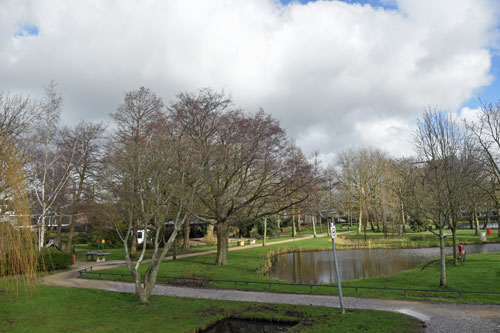
- “Kogerpark” (1926/1927), donated by mevr. Honig-Kluyver to serve the local population of Koog and Zaandijk. The construction costs were raised by donations. For a long time it was a place for music, dance, theatre, meetings etc. Walk past the Pavilion and Teahouse then straight on until:
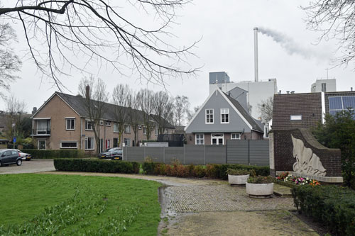
- Jonge Zwaanstraat, in front of the 2e World War monument, go left and follow until corner Stationsstraat and then turn right. At the end turn left in the direction of the startingpoint: crossing Guisweg/Lagedijk.